Thank goodness for Google maps, right? This technology makes it possible to track where you are in the world and where you’re going. But while such mapping tools are common and convenient, the science behind them isn’t as easy as typing in an address.
Land surveyors and survey monuments make it possible to keep track of where things are. The process of creating and recording a survey monument is partly how we know what the land looks like. Survey monuments are permanent physical structures that mark important points or boundary lines, which are then used as reference points to create maps.
This is a normal part of life for land surveyors at Heneghan and Associates, P.C. Land surveyors are necessary for almost every construction project, property sale or property dispute. They create maps that are referenced for years to come. These professionals collect data by going onto the land and marking its natural and man-made structures, but that’s only half of the job. Another significant chunk of their time is spent in the office, poring over historical legal documents and maps to establish where property lines are.
As surveying is one of the oldest professions out there, surveyors have a lot of information to comb through. Legal documents can show us where property lines used to be, but depending on how old they are, these markers may no longer exist. Maps, too, often only tell half the story. All of this information is vital to a surveyor’s work, but it’s also quickly outdated.
Surveyors know how useful it is to have complete and updated records, and so most of them create plats with this in mind. The goal is that their maps will be helpful to future surveyors for years to come. Brandon Egelhoff, one of our Professional Land Surveyors, approaches all of his work with that mindset. He says, “We want our work to stand the test of time. We want our predecessors to say, ‘Heneghan did good work. This surveyor did good work.’”
This is why survey monuments are such an important part of the job; they help create an official record of established points. These monuments can be anything from a post to a pit, as long as it clearly represents a boundary or other key point on a piece of land.
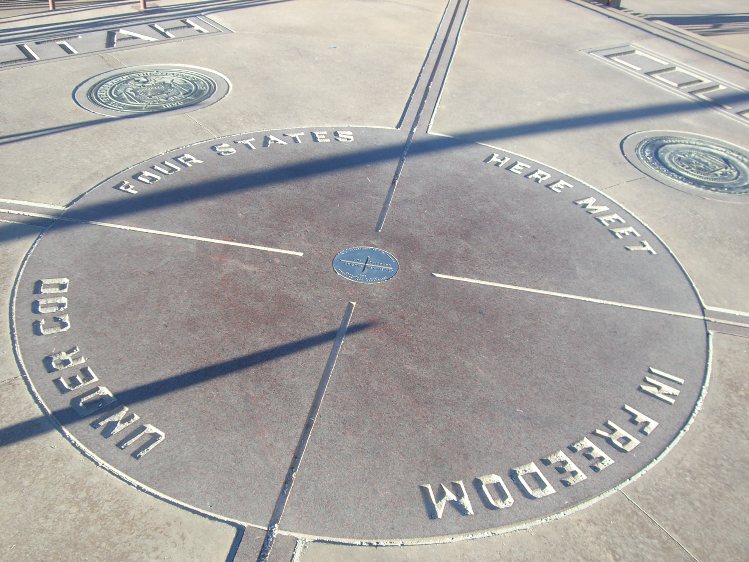
The Four Corners Monument would be a familiar example. This monument is at the point where the corners of Arizona, Colorado, New Mexico and Utah touch, as well as the boundary line between the Navajo Nation and the Ute Mountain Ute Tribe Reservation. It’s marked with a metal plate in the ground, which is the most common type of survey monument in the U.S.
Monuments must be properly recorded with the state; each state has its own regulations. In Illinois, the Land Survey Monuments Act requires surveyors to provide a description and illustration of the monument and its “accessories” (any physical characteristics or additional recorded points near the monument).
As outlined by this act, land surveyors must record survey monuments when they use an existing public land survey monument as a control corner. The term “control corner” refers to a survey monument that marks a boundary between pieces of land. The land surveyor works with their county’s Registrar of Titles to make a record of the survey monument. If a monument already has an accurate official record, then the surveyor doesn’t have to worry about recording it.
The National Geodetic Survey (NGS) collects and maintains all of this data. The NGS is a federal agency and a branch of the National Oceanic and Atmospheric Administration. It manages U.S. coordinates through the National Spatial Reference System and helps with the establishment of maps and infrastructure throughout the country.
Monument records are basically a big collaborative effort between surveyors to keep track of the land. Surveying has always required this professional teamwork. Brandon explains that surveyors might compare multiple deeds from the past few centuries in order to survey one piece of land. “You’re trying to marry what three people thought and make the most sense out of it,” he explains.
The monument records are just another piece of evidence to fit into the puzzle. And because they’re checked and updated by surveyors so often, they’re pretty accurate!
As a private landowner, there are a lot of reasons to get a survey of your property. Developers and municipalities also use surveys to plan major construction projects, among other things. Our surveyors at Heneghan and Associates, P.C. are well-equipped for any project you might throw our way! Check out our list of land surveying services and then get a free survey quote here.
If you want to talk to a surveyor about your property, or if you want to know more about how surveying works and what we could do for you, feel free to contact us or visit our website.